



AI-completed learning example
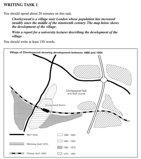
204 words · Illustrative target bandThe map above illustrates the development of Chorleywood village from 1868 to 1994. In 1868, the village already had two main roads. One ran along the western side of the village, and the other ran along the northern side. By 1883, the population grew in the eastern part of the village, situated to the east of the railway station. Overall, Chorleywood expanded considerably between 1868 and 1994, particularly after th…
Read full answer & analysis →